Landscape
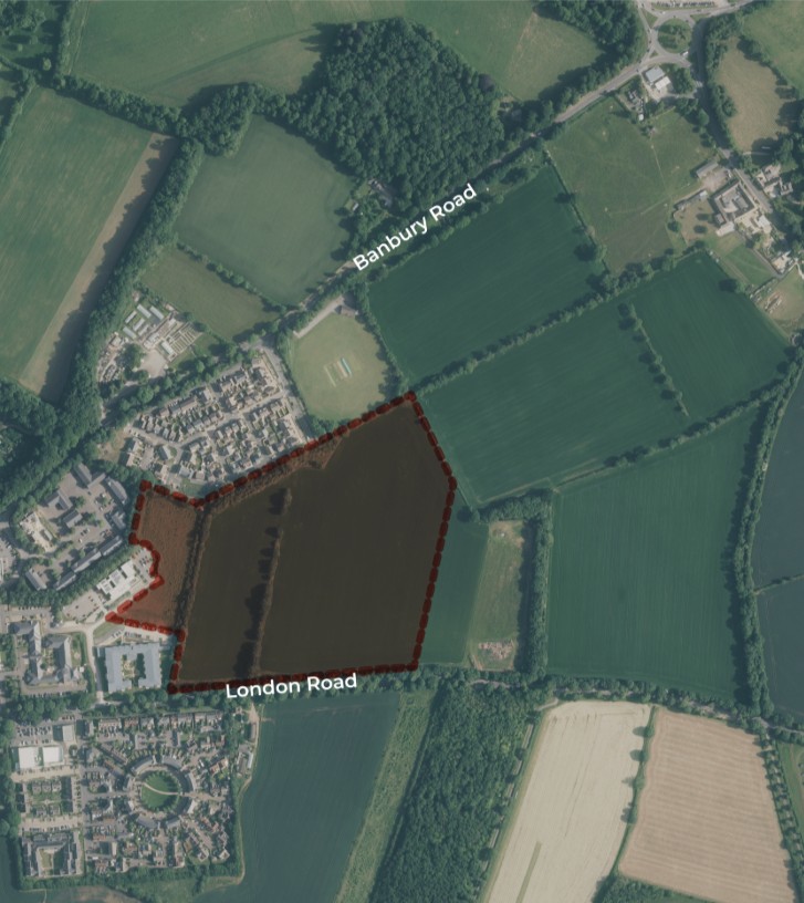
The site is well-contained by existing mature vegetation. It is broadly level and is unaffected by significant environmental or technical constraints to delivery, making it highly suitable for development, as recognised in the Adopted Local Plan.
The site lies near, but not within, the Cotswolds National Landscape (formerly AONB) which lies immediately to the north of Banbury Road. Due to the nature of the existing vegetation on Banbury Road, intervisibility between the site and the National Landscape is extremely limited, comprising filtered views during winter months when trees are not in leaf.
Biodiversity
The site contains arable land, modified grassland, other neutral grassland, hedgerows, trees and mixed scrub.
Various surveys have been undertaken over the last 12-18 months and their findings have informed the current proposals.
The development masterplan has been designed to limit the extent of built form, primarily to the area covered by arable land, which holds the least ecological value.
The important existing hedgerows, woodland edges, and the active badger setts will be retained and buffered as appropriate.
The requirement for Biodiversity Net Gain will be provided in part on-site and part off-site
Heritage
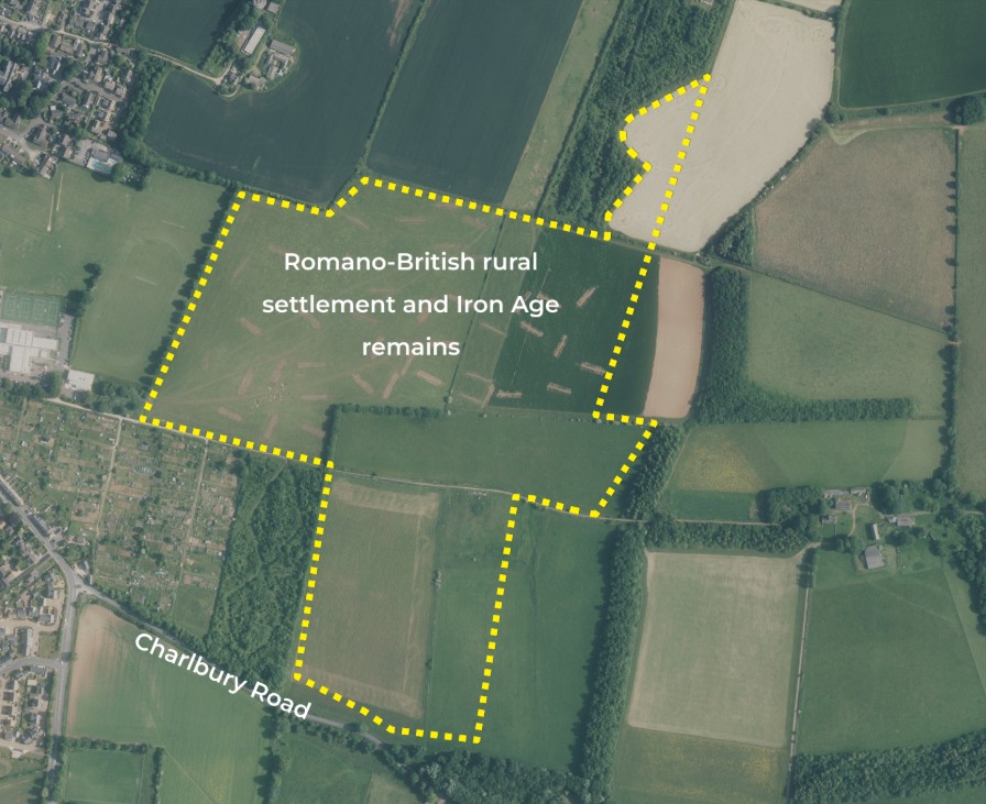
Historic England formally designated part of the East Chipping Norton SDA as a Scheduled Monument (Listing:1486619) in February 2024. This follows the finding of a Romano-British rural settlement and Iron Age remains.
That site does not extend to the land to the north of London Road. Some field patterns along with potential ridge and furrow are still being investigated.
Highways & Accessibility
- The site is exceptionally well-located, only 800m from the High Street.
- Bus stops are just 20 metres from the proposed access point, making sustainable travel easy.
- Access will be provided from both Banbury Road and London Road, accommodating cars, with dedicated pedestrian and cycle infrastructure.
- North-to-South & West-to-East cycle and pedestrian links will be created.
- Infrastructure will connect into the surrounding highway and Public Rights of Way (PRoW) network.
- Internal road design will meet Manual for Streets standards, prioritising safe, high-quality non-motorised routes.
- An EV Charging Hub with public and private charging points will be provided for electric vehicles.
- The hub will also include delivery lockers and real-time public transport timetable boards. The potential for bus service diversion through the site is also being explored.
Flood Risk & Drainage
- The site is located in Flood Zone 1 – Low Probability, according to the Environment Agency’s Flood Map. This means there is less than a 1 in 1000-year annual probability of flooding.
- Surface Water Risk Mitigation: Any surface water pooling will be addressed through drainage design.
- Natural Infiltration: The underlying geology of the site naturally allows for infiltration, ensuring that pluvial flow only occurs in extreme storm events.
Trees
- The southern access point will be carefully selected to take advantage of existing gaps in between the Memorial trees on London Road.
- Tree surveys have been undertaken for all trees within and on the perimeter of the site, and this has informed the proposals as they develop.
